China Doubles Down On New Map, Tells India To Keep Calm And Not To ‘Over-Interpret’
Relevance: GS 2 - India and its neighbourhood- relations; Effect of policies and politics of developed and developing countries on India’s interests, Indian diaspora.
(Source: The Hindu, 08/31/23)
Click here for Daily Current Affairs
Why in the news?
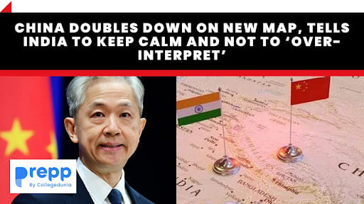
- India lodged a “strong protest” over the new map that was released recently by China, which showed all of the Indian State of Arunachal Pradesh, Aksai Chin, as well as the entire South China Sea within China’s borders.
- China defended it stating that it was “a routine practice” and asking New Delhi to “refrain from over-interpreting” it.
Table of Contents
India-China border tensions
- India perceived this move as unnecessary and likely to worsen their already tense relations, particularly concerning border issues.
- In 2019, India released a map showing Ladakh as a newly created union territory. This change didn't alter India's external borders, and India communicated this to Beijing. Nevertheless, China strongly objected to this move and protested against it.
What is the source of tension?
- A Disputed Border and Shifting Dynamics: The primary source of tension lies in the ill-defined, 3,440 km-long border that divides the two nations.
- Rivers, lakes, and shifting snowcaps contribute to the changing demarcation, causing frequent face-offs between soldiers at various points.
- The ties between India and China were severely strained following the eastern Ladakh border row that began in May 2020.
- The Indian and Chinese troops are locked in an over three-year confrontation in specific friction points in eastern Ladakh even as the two sides completed disengagement from several areas following extensive diplomatic and military talks.
- Infrastructure: Both countries are also engaged in constructing infrastructure along the border, adding complexity to the situation. India's construction of a high-altitude air base road was a key trigger for a deadly clash in 2020.
- Confrontation: The 2020 Galwan Valley confrontation, where soldiers battled with rudimentary weapons, resulted in casualties on both sides, marking the first fatal clash since 1975. The use of firearms, previously prohibited by a 1996 agreement, occurred in 2021, heightening the danger.
Conclusion
- The India-China border tensions illuminate the complexities of modern geopolitics. Beyond territorial disputes, the dynamics involve nuclear powers, economic interdependence, and intricate political relationships.
- The need for peaceful resolution is paramount, not only for the two nations but for global stability.
- The situation serves as a reminder that effective diplomacy and strategic communication are essential to prevent the escalation of regional conflicts that could have worldwide ramifications.
(*Click this link to read prelims specific weekly current affairs articles)
FAQs
Question: What is the cause of border disputes between India and China?
Answer:
There is no mutually recognised official border between India and China. Instead, the two countries have a 3,488 -kilometre-long Line of Actual Control (LAC). This LAC runs through Ladakh, Uttarakhand, Himachal Pradesh, Sikkim, and Arunachal Pradesh on the Indian side, and the Tibet Autonomous Region on the Chinese side.
Question: Which Indian states have borders with China?
Answer:
India shares 3488 Km of border with China that runs along the States of
Jammu & Kashmir, Himachal Pradesh, Uttarakhand, Sikkim and Arunachal
Pradesh.
Question: Which section of the India-China border is known as the McMahon Line?
Answer:
The northern portion of the India-China border is known as the Mac Mohan line. Sir Henry McMahon, the then Foreign Secretary in the Government of British India, demarcated this line, which became known as the McMahon Line after his name. This line stretches for 890 kilometres.
MCQ
Question: Siachen Glacier is situated to the (UPSC-2020)
(a) East of Aksai Chin
(b) East of Leh
(c) North of Gilgit
(d) North of Nubra Valley
Answer: (d) See the Explanation
- The Siachen Glacier is located to the north of the Nubra Valley in the eastern Karakoram Range of the Himalayas.
- Therefore, option (d) is the correct answer.
Download the PREPP App and attempt FREE IAS Exam Mock Tests and get complete study material!

Full Test - 04: UPSC CSE Prelims CSAT (Paper-II)
Full Test - 03: UPSC CSE Prelims CSAT (Paper-II)
UPSC CSE Prelims 2026 GS Paper 1 Question Paper (24-May-2026)
UPSC CSE Prelims 2026 CSAT Paper 2 Question Paper (24-May-2026)

17 February 2025 | The Hindu Must Read Articles | Current Affairs

16 February 2026 | The Hindu Must Read Articles | Current Affairs

13 February 2026 | The Hindu Must Read Articles | Current Affairs









Comments