Why Are Earthquakes Frequent In Afghanistan?
Relevance: GS1 - Important Geophysical phenomena such as earthquakes, tsunamis, volcanic activity, cyclones etc, GS3 -Disaster and disaster management. Prelims- Current events of international importance
(Source: The Hindu, 10/20/2023)
Click here for Daily Current Affairs
Why in the news?
- Recently, an earthquake of magnitude 6.3 struck Western Afghanistan on October 15 following multiple earthquakes of similar strength that resulted in the deaths of over a thousand people in Herat province.
- Afghanistan has faced widespread destruction due to earthquakes over the years as it is located over multiple fault lines.
Table of Contents
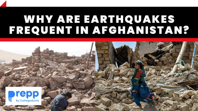
Earthquake in Afghanistan
- According to the U.S. Geological Survey, an earthquake of magnitude 6.3 struck Western Afghanistan on 15th October 2023.
- The earthquake was centered about 30 kilometers north-northwest of Herāt, the capital of Afghanistan’s Northwest province.
- One earthquake of 6.3 magnitude had already occurred on October 11th and two others of a similar magnitude occurred on October 7th.
- The last earthquake registered at a depth of 6.3 km along the same fault planes as the previous three earthquakes.
- It was followed by a 5.5 magnitude aftershock.
- Casualties:
- The Afghanistan Ministry of Disaster Management revised the death toll from multiple earthquakes from 2,400 to around 1,000.
- According to UNICEF, more than 90% of those killed were women and children.
- Humanitarian challenge:
- Traditional houses: Most homes in rural Afghanistan are built of wood or mud instead of steel and concrete.
- Large families: Multi-generational extended families generally live together which could lead to a large loss of life in the community in case an earthquake or similar disaster occurs.
- Lack of financial aid: The withdrawal of foreign aid following the Taliban's return to power has compromised the country’s ability to respond to disasters.
- Taliban government: The corrupt, unaccountable, and centralized system of government has proved inefficient in responding to disasters.
History of earthquakes in Afghanistan
- Afghanistan has faced widespread destruction from intense earthquakes over the years.
- In June 2022, an earthquake of magnitude 6.1 in the Khost and Paktika provinces led to the loss of around 1,000 lives.
- In 2015, a major earthquake in northeast Afghanistan led to the death of an estimated 200 people in Afghanistan and northern Pakistan.
- In 2002, an earthquake of 6.1 magnitude in northern Afghanistan killed 1,000 people.
- In 1998, an earthquake and subsequent tremors in northeast Afghanistan led to the deaths of more than 4,500 people.

Why do frequent earthquakes occur in Afghanistan?
Intersection of plates
- Afghanistan, which is situated on the Eurasian plate, is frequently hit by earthquakes, especially in the Hindu Kush mountain range, due to its proximity to the junction of the Eurasian and Indian tectonic plates.
Tectonic activity
- The region witnesses significant tectonic activity due to the frequent collisions of the plates.
- The Arabian plate subducts under Eurasia in the northward direction towards western Afghanistan.
- In eastern Afghanistan, the Indian plate subducts under the Eurasian plate.
- In southern Afghanistan, the Arabian and Indian plates adjoin and subduct northward under the Eurasian plate.
- The geological complex junction between the tectonic plates also hosts the Hindu Kush mountains and the Pamir Knot.
India-Eurasian plate interactions:
- As a result of the collision and convergence of the Indian Plate and the Eurasian Plate, folding and faulting occur in the Earth’s crust, leading to the occurrence of earthquakes in the region.
- The ongoing northward movement of the Indian Plate towards the Eurasian Plate leads to compression.
- This results in the uplift of the Himalayas and the transmission of tectonic stress across the entire region.
- Compression causes the crust to deform, creating faults and fractures that can slip and generate earthquakes.
- These interactions at plate boundaries generate significant tectonic stresses and result in earthquakes.
Fault systems in Afghanistan
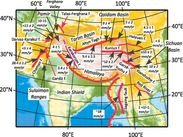
- Various active fault systems are present across Afghanistan which is a source of earthquakes in the region.
- Faulting leads to the storage of tension in rocks in the earth's interior.
- When this tension is released as kinetic energy through weak zones on the surface, earthquakes occur.
- Major fault systems in the region include the Chaman Fault and the Main Pamir Thrust.
What is the anatomy of earthquakes?
- The earth is made up of chunks of solid rocks called tectonic plates which are slow moving but always in motion due to the heat energy generated inside the earth.
- The movement of these plates leads to discontinuities, also known as fault lines.
- These fractures which cause the rock to break and slip are caused by tectonic forces and the stress built up in the earth’s lithosphere, causing the rocks to break and slip.
- When blocks of the lithosphere suddenly slip past one another, earthquakes occur leading to the release of energy and seismic waves.
- The surface where the lithosphere chunks slip becomes a fault plane and the point where the fault rupture starts and produces an earthquake is called the focus or the hypocentre.
- The point on the surface of the earth directly above it is called the Epicentre.
- The edges of these plates are called plate boundaries and consist of faults, making it the place where earthquakes are most common.
To learn more about earthquakes, click the link.
(*Click this link to read prelims specific weekly current affairs articles)
FAQs
Question: What are faults?
Answer:
Faults are fractures in the Earth’s crust where rocks on either side have slid past each other. They can be tiny or even hundreds of kilometers long. There are three types of faults - strike-slip, normal, and thrust (reverse) faults.
Question: How is the magnitude of an earthquake measured?
Answer:
The magnitude of an earthquake is measured on the Richter scale. The magnitude of an earthquake is related to the energy released during the earthquake. It is expressed in absolute numbers from 0 and 10.
Question: What are folds?
Answer:
A fold is a wave-like structure that forms when rocks or a part of the earth’s crust is deformed due to compressional stress. Folds are made up of multiple strata of rocks. They can be anticlines (upward convex) and synclines (downward convex). Folding leads to the formation of mountains like the Alps and the Himalayas.
|
UPSC Mains Practice Questions Q.1) Why are the world’s fold mountain systems located along the margins of continents? Bring out the association between the global distribution of Fold Mountains and the earthquakes and volcanoes. (UPSC GS1 2014) Q.2) The frequency of earthquakes appears to have increased in the Indian subcontinent. However, India’s preparedness for mitigating their impact has significant gaps. Discuss various aspects. (UPSC GS3 2015) Q.3) Define mantle plume and explain its role in plate tectonics. (UPSC GS1 2018) |
MCQs
Question: Consider the following countries:
- Azerbaijan
- Kyrgyzstan
- Tajikistan
- Turkmenistan
- Uzbekistan
Which of the above has borders with Afghanistan?
(a) 1, 2 and 5 only
(b) 1, 2, 3 and 4 only
(c) 3, 4 and 5 only
(d) 1, 2, 3, 4 and 5
Answer: (c) See the Explanation
- Afghanistan is a landlocked country bordered by
- Pakistan in the east and south
- Iran in the west
- Turkmenistan, Uzbekistan, and Tajikistan in the north
- China in the northeast.
Therefore, option (c) is the correct answer.
Download the PREPP App and attempt FREE IAS Exam Mock Tests and get complete study material!

Full Test - 04: UPSC CSE Prelims CSAT (Paper-II)
Full Test - 03: UPSC CSE Prelims CSAT (Paper-II)
UPSC CSE Prelims 2026 GS Paper 1 Question Paper (24-May-2026)
UPSC CSE Prelims 2026 CSAT Paper 2 Question Paper (24-May-2026)

17 February 2025 | The Hindu Must Read Articles | Current Affairs

16 February 2026 | The Hindu Must Read Articles | Current Affairs

13 February 2026 | The Hindu Must Read Articles | Current Affairs









Comments