Mitigating Tragedies in the Himalayan Region
Primary Source: The Hindu
Click here for Daily Current Affairs
Prepp Prelims Booster: GLOF, South Lhonak and Shako Cho glacial lakes in Sikkim
Prepp Mains Booster: Disaster and Disaster Management, Management of Disasters, Community Level Disaster Management, Government Initiatives on Disaster Management, Himalayan region and the associated challenges, Climate Change
Why in the news?
- A recent glacial lake outburst flood (GLOF) in Sikkim caused significant damage along the Teesta river, highlighting the escalating risk of climate change-induced GLOFs in the Indian Himalayan Region.
- A study reveals that 90 million people in 30 countries are at risk, living near glacial lakes, with a significant number residing close to potential GLOF pathways.
Table of Contents
- What Triggered the Sikkim GLOF Event?
- What is a Glacial Lake Outburst Flood (GLOF)?
- Himalayan Region’s Vulnerabilities
- National Disaster Management Authority (NDMA)
- Challenges Associated with Monitoring of GLOF in Himalayan Region
- Mitigation Efforts for GLOF
- What is the Impact of GLOF on Communities?
- Multi-disciplinary Approach Towards GLOF
- Conclusion
- FAQs
- MCQs
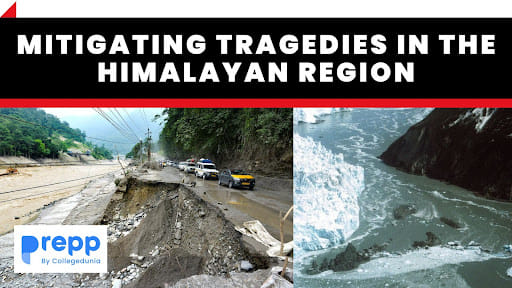
What Triggered the Sikkim GLOF Event?
- A recent glacial lake outburst flood (GLOF) occurred in Sikkim, causing significant devastation along the Teesta River.
- The particular event in focus transpired at the South Lhonak glacial lake in Sikkim.
- The magnitude and full extent of the tragedy at the South Lhonak glacial lake were still unfolding at the time of the article.
- In September, prior to the GLOF event, the National Disaster Management Authority (NDMA) had conducted a mission to South Lhonak and Shako Cho glacial lakes. They installed solar-powered automated cameras and monitoring equipment.
- The equipment at South Lhonak had reported higher-than-normal temperatures of zero to 5°C in the four days that data was received, which is unusually warm for Himalayan glaciers.
- While the exact combination of causes of the GLOF was yet to be fully determined, monitoring equipment highlighted exceptionally warm temperatures for Himalayan glaciers in the days leading to the event.
- Scientists are leaning towards the theory that a significant trigger for the disaster was the collapse of a massive mass of rock/moraine from the north-western bank of the lake.
- This collapse, estimated to be more than a quarter-million cubic meters in volume, displaced a considerable amount of meltwater. This displacement widened the river mouth at the eastern end, leading to the flash floods.
What is a Glacial Lake Outburst Flood (GLOF)?
- A Glacial Lake Outburst Flood (GLOF) is a type of flood that occurs when the dam containing a glacial lake fails.
- This dam can be made of glacier ice itself or a terminal moraine (accumulated earth and rock debris).
- When the dam breaks, it releases a large amount of water stored in the glacial lake, causing flooding downstream.
- Several factors can trigger a GLOF, including:
- Rapid melting of the glacier: This can be due to rising temperatures associated with climate change or volcanic activity.
- Avalanches of snow or rock into the lake: This can lead to a sudden displacement of water.
- Earthquakes: They can cause the lake's dam to crack or fail.
- Erosion: The constant flow of liquid water can weaken the ice or moraine dam over time.
- Collapse of an adjacent glacial lake: Sometimes, one glacial lake can drain into another, causing the second lake to overflow.
- GLOFs are significant because they can release vast amounts of water and debris in a short time, leading to catastrophic consequences for communities and infrastructure downstream.
- With the ongoing effects of climate change, there is growing concern about the increasing frequency and magnitude of GLOFs, especially in regions with significant glacial coverage like the Himalayas.
Himalayan Region’s Vulnerabilities
Hydro-meteorological Hazards
- Glacial Lake Outburst Floods (GLOFs): With rising temperatures, glacial melt has increased, leading to the formation and expansion of glacial lakes. These lakes can suddenly release large volumes of water, causing flash floods downstream.
- Landslides: Heavy rainfall, rapid snowmelt, or sudden release of water from glacial lakes can trigger landslides in the steep terrains of the Himalayas.
- Flash Floods: The narrow valleys and steep terrain combined with heavy rainfall or sudden glacial lake outbursts can lead to rapid and destructive floods.
- Avalanches: Heavy snowfall, changing temperature, or disturbances can trigger avalanches in snow-laden areas.
Tectonic Hazards
- Earthquakes: The Himalayan region is one of the most seismically active zones in the world.
- It lies at the convergent boundary between the Indian plate and the Eurasian plate.
- The ongoing collision and plate movements cause frequent and sometimes massive earthquakes.
Climate Hazards
- Temperature Increase: The Himalayan region has been warming at a rate faster than the global average. This has implications for glacial melt, local biodiversity, and traditional livelihoods.
- Changing Rainfall Patterns: There have been shifts in the monsoon patterns, which can lead to prolonged dry spells and unexpected heavy rainfall events.
- Glacial Retreat: Many Himalayan glaciers are retreating due to global warming, impacting river systems downstream and increasing the risk of GLOFs.
Human-induced Hazards
- Deforestation: Clearing forests for agriculture, urbanization, or other purposes destabilizes slopes and makes them more prone to landslides.
- Infrastructure Development: Road and dam construction without proper environmental considerations can exacerbate the risk of landslides and disrupt natural drainage systems.
- Population Pressure: Increasing populations in vulnerable areas can lead to overexploitation of resources and increased vulnerability to natural disasters.
- Mining Activities: Unsustainable mining practices can destabilize mountain slopes and lead to environmental degradation.
- Tourism Pressures: Unregulated tourism can strain local ecosystems, lead to waste management issues, and increase the carbon footprint.
Early Warning Systems
- Early Warning Systems (EWS) are comprehensive mechanisms designed to detect, analyze, and prompt actions to prevent or mitigate potential disasters and their impacts.
- The primary purpose of an EWS is to give individuals and communities timely and appropriate information that allows them to prepare and to reduce the possibility of harm or loss.
- Here are the fundamental components of Early Warning Systems:
- Hazard Detection and Monitoring: This is the initial phase where potential hazards are identified and closely observed.
- Advanced technologies, such as remote sensing, seismographs for earthquakes, hydrological sensors for rising water levels, or meteorological stations for weather disturbances, are used to continuously monitor and detect anomalies.
- Data Analysis and Risk Assessment: The collected data is then processed and analyzed to assess the impending risk.
- Dissemination and Communication: Once a potential hazard is detected and analyzed, the information needs to be relayed to the authorities, stakeholders, and communities at risk.
- This can be done through various means, including radio broadcasts, SMS alerts, sirens, mobile apps, and social media.
- Response Capability: This component focuses on how individuals, communities, and authorities act upon receiving the early warning.
- It includes preparedness measures, emergency response plans, and public education and training, ensuring that people know how to react when they receive a warning.
- Hazard Detection and Monitoring: This is the initial phase where potential hazards are identified and closely observed.
National Disaster Management Authority (NDMA)
|
Challenges Associated with Monitoring of GLOF in Himalayan Region
- Remote and Inaccessible Terrain: Much of the Himalayan region is remote and difficult to access, which makes on-ground monitoring, equipment installations, and maintenance arduous.
- Varied and Extreme Climate Conditions: The extreme cold, frequent snowfalls, and avalanches can disrupt monitoring equipment, damage infrastructure, and pose risks to personnel involved in monitoring and mitigation activities.
- Diverse Glacier Dynamics: The Himalayan region is vast, and its glaciers and glacial lakes vary significantly in size, type, and behavior. This diversity makes it difficult to have a one-size-fits-all monitoring or mitigation approach.
- Technical Limitations: Establishing real-time monitoring and early warning systems in such a challenging environment requires advanced technology, which might be hard to implement uniformly across the region.
- Infrastructure Challenges: Building infrastructure like check dams, spillways, or drainage channels above 5,000 meters is challenging due to issues like inaccessibility, difficulties in transporting and retaining excavation equipment, strong winds, and sourcing power and connectivity.
- Local Communities and Awareness: Many communities in the Himalayas might not be fully aware of the risks of GLOFs or how to respond to early warnings. Conducting awareness programs in such remote areas can be challenging.
- Transboundary Issues: The Himalayan range spans several countries, and glacial lakes in one country might pose a threat to areas in a neighboring country. Effective monitoring and mitigation require transboundary cooperation, which can be complicated due to geopolitical issues.
- Economic Constraints: Comprehensive monitoring and mitigation measures require significant financial resources. Given the many other socio-economic challenges in the region, prioritizing and allocating sufficient funds for GLOF-specific measures can be challenging.
- Socio-Cultural Considerations: Implementation of mitigation measures might necessitate relocation of local communities or changes in land use, which can be sensitive issues given the deep cultural and spiritual ties many Himalayan communities have with their land.
Mitigation Efforts for GLOF
- Early Warning Systems (EWS): Installing EWS to detect potential threats and promptly alert vulnerable communities.
- Structural Interventions:
- Controlled Drainage: Creating controlled drainage channels to reduce the volume of water in potentially dangerous glacial lakes.
- Spillways: Constructing spillways to control and direct outflows, reducing the risk of sudden outbursts.
- Check Dams and Catchment Dams: Building these structures to reduce the speed of outflows, thereby diminishing the downstream impact.
- Reinforcing Lake Moraines: Strengthening natural barriers like moraines (debris ridges) to reduce the likelihood of their failure.
- Remote Sensing and Satellite Monitoring: Using satellite imagery to continuously monitor glacial lake dynamics and identify potential danger zones.
- Research and Data Collection: Conducting detailed studies of glaciers, glacial lakes, and downstream areas to understand GLOF dynamics better and to predict potential outburst scenarios.
- Community-Based Approaches:
- Awareness and Education: Conducting awareness campaigns and educational programs to inform local communities about GLOF risks and response mechanisms.
- Evacuation Plans: Preparing and rehearsing evacuation plans with communities living in potential GLOF paths.
- Community Monitoring: Training local individuals to monitor glacial lakes and report any anomalies, effectively leveraging local knowledge and presence.
- Land-use Planning and Zoning: Implementing land-use regulations to prevent the establishment of critical infrastructure or dense human settlements in high-risk zones.
- Integrating GLOF Risks into Broader Policies: Incorporating GLOF considerations into broader environmental, developmental, and urban planning policies ensures that such risks are considered during infrastructure development, urbanization, and other major decisions.
What is the Impact of GLOF on Communities?
- Loss of Life: GLOFs can result in immediate fatalities due to the sudden release of massive volumes of water, carrying debris and rocks downstream.
- Displacement: The floods may destroy homes and settlements, forcing residents to evacuate and relocate, sometimes permanently.
- Loss of Livelihood: GLOFs can inundate agricultural lands, resulting in loss of crops, soil erosion, and sediment deposition that renders fields unproductive.
- Infrastructure Damage: Essential infrastructure such as roads, bridges, schools, healthcare facilities, and electricity setups can be severely damaged or destroyed, cutting off connectivity and essential services.
- Environmental Impact: GLOFs can result in extensive environmental degradation. The sudden floods can erode soil, damage local flora and fauna, and disrupt local ecosystems.
- Economic Impact: Apart from immediate damages, the long-term economic growth of affected regions can be stunted. Repairing infrastructure, compensating for lost assets, and rebuilding communities require significant funds.
- Permanent Changes in Topography: Massive floods can alter the physical landscape, changing river courses, creating new lakes, or permanently submerging lands.
- Increased Vulnerability: Once affected by GLOFs, communities might be at heightened risk from other disasters, given the changed landscape, reduced resources, and weakened infrastructural setups.
- Lack of Awareness and Preparedness: Many communities might not be fully aware of GLOF risks or how to respond to early warnings, leading to greater vulnerability.
Multi-disciplinary Approach Towards GLOF
Awareness and Study
- A study in Nature showed that a significant number of people are at risk due to GLOFs.
- The cascading nature of mountain hazards, starting with events like heavy rainfall and leading to GLOFs, underscores the intricacy of predicting such occurrences.
Early Warning Systems
- Instruments are installed at high-altitude lakes for monitoring.
- Despite some setbacks, these systems are crucial in gathering data and enhancing our understanding of the potential threats.
- Plans are in place to improve these systems further.
Scientific Monitoring
- Monitoring equipment have reported abnormal temperatures, indicating potential triggers for GLOFs.
- There is a need for continuous monitoring, considering the variability in glacial recession.
Data Compilation
- The National Remote Sensing Centre’s (NRSC) Glacial Lake Atlas of 2023 has mapped glacial lakes, highlighting potential danger zones.
Geo-technical Solutions
- Various global strategies, such as drainage systems, spillways, and catchment dams, have been trialed to mitigate GLOFs.
- These methods, while promising, face challenges at high altitudes, including difficulties in equipment transportation and power sourcing.
Community Engagement
- Local communities are often unaware of the risks they face. Effective disaster response and recovery hinge on informing and preparing these communities.
Policy Integration
- Disaster and climate resilience principles must be embedded within governmental policies, practices, and even private investment initiatives.
Collaborative, Multi-disciplinary Efforts
- Remote sensing has provided high-resolution data to monitor spatial changes.
- The Central Water Commission works on hydro-dynamic assessments of risky lakes.
- The NDMA offers national guidelines to states, offering an overview of hazards and suggesting risk-reduction strategies.
- Governments and scientific institutions must come together to pool resources and expertise in disaster risk reduction.
National Remote Sensing Centre’s (NRSC) Glacial Lake Atlas of 2023
|
Conclusion
The event underscores the larger issue of climate change and its impact on glacial regions, emphasizing the need for better monitoring, early warning systems, and mitigation measures to protect vulnerable areas and populations.
(*Click this link to read prelims specific weekly current affairs articles)
FAQs
Question: What is Glacial Lake Outburst Flood (GLOF)?
Answer:
A Glacial Lake Outburst Flood, or GLOF, is the rapid outpouring of water from a lake fed by glacier melt that has formed at the glacier's side, in front, under, beneath, or on its surface.
Question: What is the significance of GLOF in the context of the Indian Himalayan Region?
Answer:
In the context of the Indian Himalayan Region, GLOFs are becoming increasingly significant due to climate change. The recent flood in Sikkim, caused by a GLOF, has highlighted the risk of climate change-induced GLOFs across this region, where many communities are situated close to glacial lakes and their outflow channels, making them vulnerable to such disasters.
Question: What do you mean by Early Warning Systems?
Answer:
Early Warning Systems (EWS) are comprehensive mechanisms designed to detect, analyze, and prompt actions to prevent or mitigate potential disasters and their impacts. The primary purpose of an EWS is to give individuals and communities timely and appropriate information that allows them to prepare and to reduce the possibility of harm or loss.
UPSC Mains Practice Question:
|
MCQs
Question: Which of the following played a significant role in the recent GLOF event at the South Lhonak glacial lake in Sikkim?
(a) Abnormally high temperatures for Himalayan glaciers
(b) A sudden increase in rainfall in the region
(c) Melting of the entire glacier in a single day
(d) Rapid increase in human activities near the glacier
Answer: (a) See the Explanation
Iin the days leading up to the GLOF event, monitoring equipment reported higher-than-normal temperatures of zero to 5°C — exceptionally warm for Himalayan glaciers. This indicates that the abnormally high temperatures could have played a significant role in triggering the GLOF.
Therefore, option (a) is the correct answer.
Question: What percentage of glacial lakes greater than 0.25 hectares in the Indus, Ganga, and Brahmaputra basins are located in India, according to the National Remote Sensing Centre’s (NRSC) Glacial Lake Atlas of 2023?
(a) 15%
(b) 27%
(c) 40%
(d) 52%
Answer: (b) See the Explanation
According to the NRSC's Glacial Lake Atlas of 2023, 27% of the glacial lakes greater than 0.25 hectares in area in the three major river basins (Indus, Ganga, and Brahmaputra, are located in India.
Therefore, option (b) is the correct answer.
Download the PREPP App and attempt FREE IAS Exam Mock Tests and get complete study material!

Full Test - 04: UPSC CSE Prelims CSAT (Paper-II)
Full Test - 03: UPSC CSE Prelims CSAT (Paper-II)
UPSC CSE Prelims 2026 GS Paper 1 Question Paper (24-May-2026)
UPSC CSE Prelims 2026 CSAT Paper 2 Question Paper (24-May-2026)

17 February 2025 | The Hindu Must Read Articles | Current Affairs

16 February 2026 | The Hindu Must Read Articles | Current Affairs

13 February 2026 | The Hindu Must Read Articles | Current Affairs









Comments