
Understanding Horizontal Equivalent for Vertical Beds
The horizontal equivalent (HE) represents the horizontal distance on a map corresponding to a specific vertical interval (VI) between contour lines, considering the dip angle of a geological feature.
Calculating Horizontal Equivalent
The relationship between HE, VI, and the dip angle ($\theta$) is given by the formula:
$HE = VI / tan($\theta$)$
- $HE$ is the Horizontal Equivalent.
- $VI$ is the Vertical Interval between successive contour lines.
- $\theta$ is the dip angle of the geological bed.
Applying to a Vertical Bed
For a vertical bed, the dip angle is 90 degrees. Therefore, $\theta = 90^\circ$.
We need to evaluate tan(90°). The tangent function approaches infinity as the angle approaches 90 degrees.
Substituting this into the formula:
$HE = VI / tan(90^\circ)$
Since tan(90°) is mathematically undefined (approaches infinity), dividing the Vertical Interval (VI) by infinity results in zero.
$HE = VI / $\infty$ = 0$
Conclusion
The horizontal equivalent measured between two successive strike lines on a map for a vertical bed is zero. This is because a vertical bed maintains its horizontal position regardless of elevation change; any vertical distance corresponds to no horizontal distance along the dip.
Important Questions from Folds
The following figure shows the lower hemisphere, equal area plots of the poles to bedding surfaces. Which one of the following is the correct interpretation?
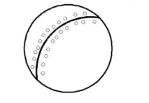
- The intersection of bedding surface with upright slaty cleavage surface occurs as horizontal lineation. Which one of the following is the most likely interpretation? The bedding surfaces are folded into
Figures A and B show two cross-sections of a folded sandstone bed.
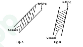
Which one of the following is the correct interpretation of the Figs. A and B?
Match the outcrop patterns of folds with corresponding types.
Outcrop Patterns Fold A. 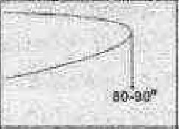
P. Plunging antiform B. 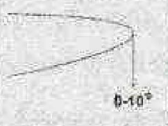
Q. Plunging synform C. 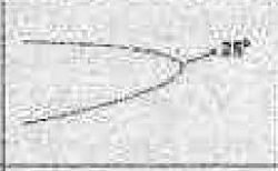
R. Reclined D. 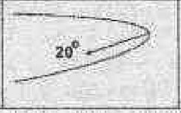
S. Recumbent - Which one of the following is the correct angle between the hinge line and the strike line of the axial plane in a reclined fold?


