
A contour line joins locations having the same height above the mean sea level. The following is a contour plot of a geographical region. Contour lines are shown at 25 m intervals in this plot. 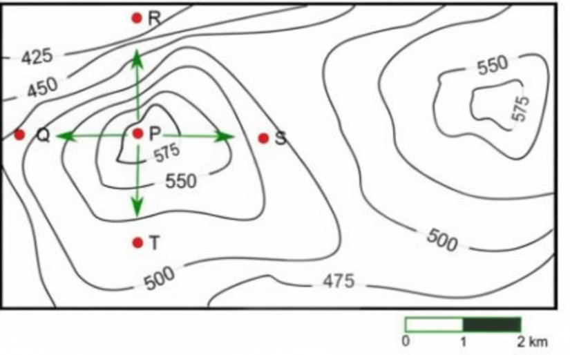
Which of the following is the steepest path leaving from P?
P to R
To determine the steepest path from point P, we must analyze the contour lines in the given plot. Contour lines join points of equal height above sea level, and the steepness of the terrain is indicated by the spacing between these lines.
The closer the contour lines, the steeper the slope. We need to compare the spacing between the contour lines from P to each of the points Q, R, S, and T.
- Contour Intervals: Each contour line represents a 25 m change in elevation.
- Path P to Q: The contour lines are widely spaced, indicating a gentle slope.
- Path P to R: The contour lines are closely spaced, indicating a steep slope.
- Path P to S: The contour lines are more spaced compared to P to R.
- Path P to T: Again, the contour lines are widely spaced, indicating a gentle slope.
Based on the analysis of contour line spacing:
- The path from P to R has the closest contour lines, indicating it is the steepest path.
Therefore, the correct answer is P to R.
Important Questions from Maps
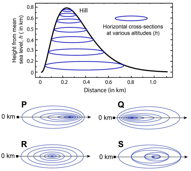
In the given diagram, ovals are marked at different heights ($h$) of a hill. Which one of the following options P, Q, R, and S depicts the top view of the hill?
- A site in a map drawn to scale of 1:16000 measures 75 sqcm. The actual area of the site in hectares is


